South Dakota’s population continues to circle the drain Gann Valley. The U.S. Census Bureau calculates that South Dakota’s mathematical center of population, the place where South Dakota would balance perfectly if it were one flat, featureless sheet and we placed identically weighted markers at the address of each person counted by the Census, is at 43° 59′ 11″ N, 98° 55′ 20″ W. That’s a spot out in a lonely pasture on the west side of the section framed by 234th Street and 364th Avenue, less than four and a half crow-flying miles southeast of Gann Valley.
KELO-TV puts up a map from Nexstar’s Addy Bink showing South Dakota’s center of population gravity has since pioneer days traced a counterclockwise arc around Wessington Springs but since 1960 has tightened its path to stay within a healthy cow chase around Gann Valley:
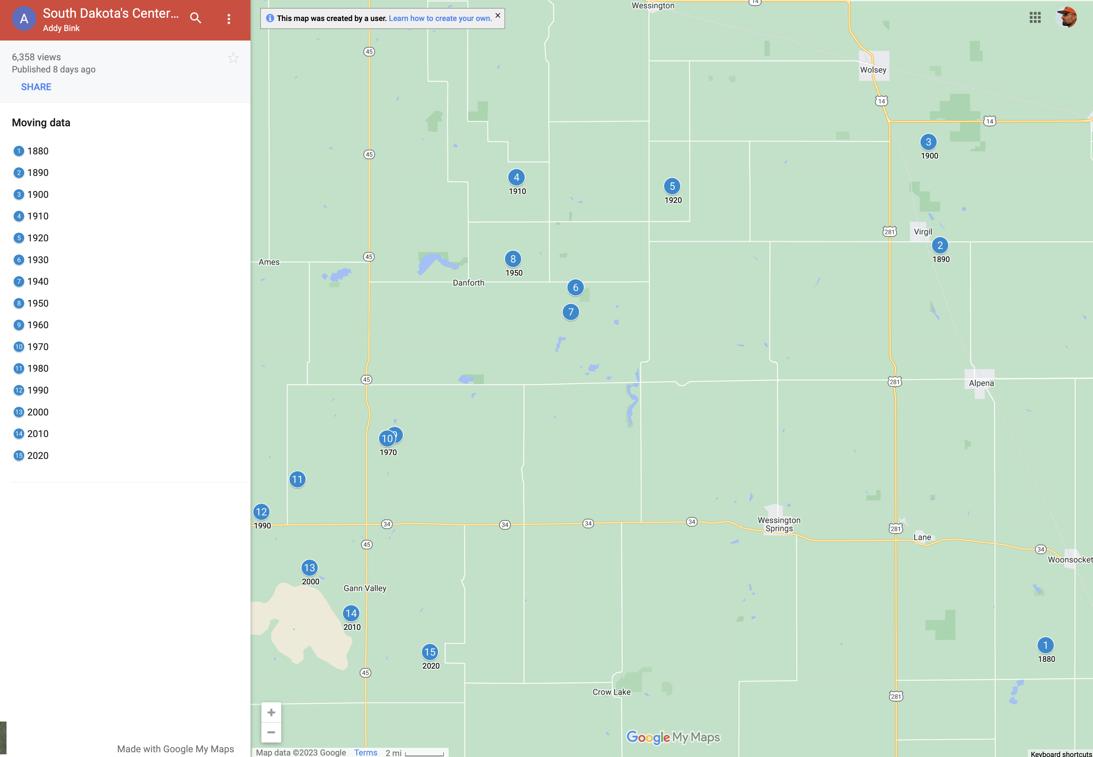
It’s interesting to note that the state’s population trended westward from statehood until 1990. Growth in Sioux Falls has pulled that center back east since then, but not by much. And big shifts north in the first couple decades, South Dakota’s population center has marched back south every decade since 1900.
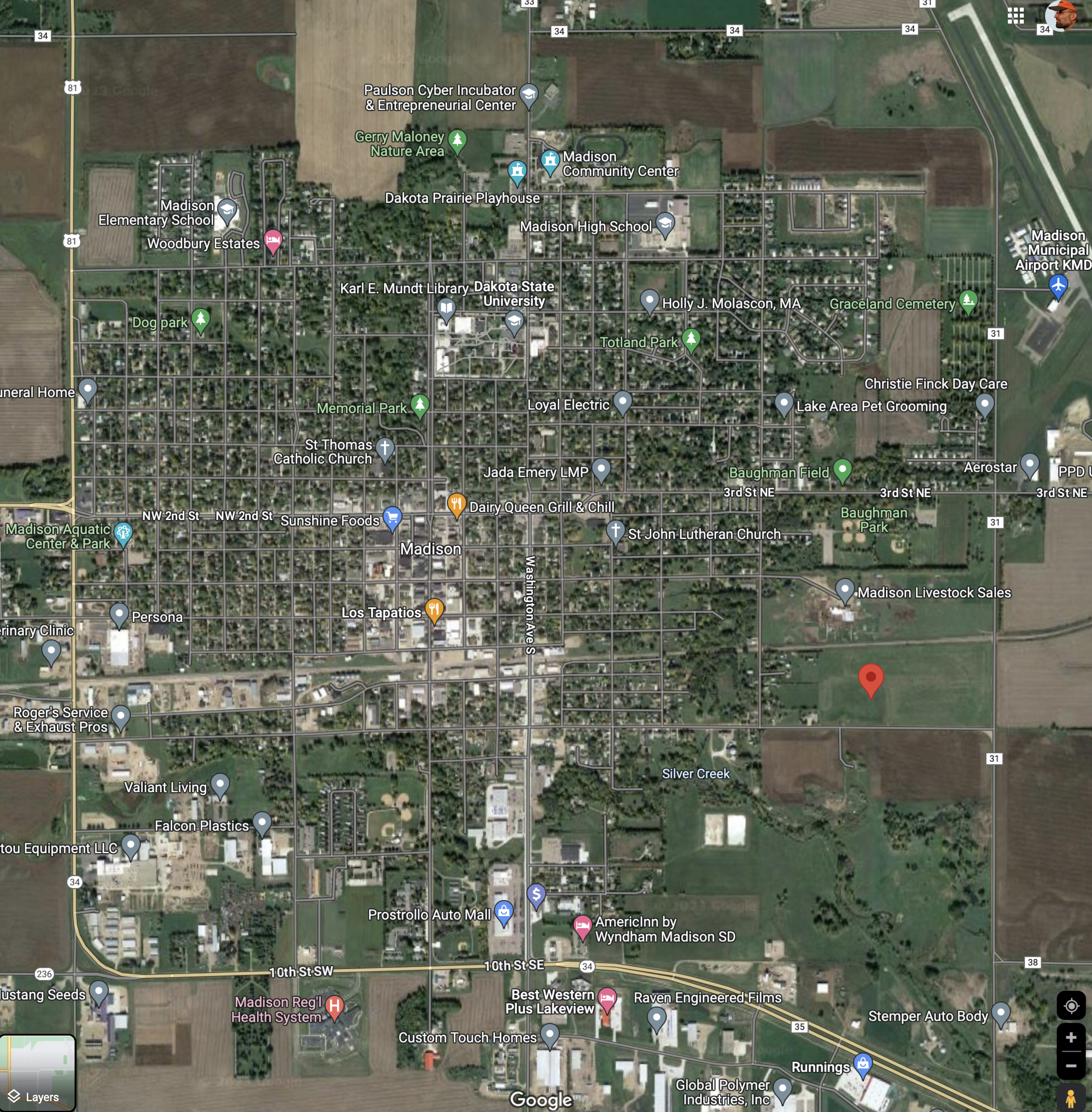
For the deeply map-curious, the Census Bureau also provides centers of population for each county. For example, in Lake County, one would expect the population center to be in Madison, the county seat located just south of the center of the 24×24-mile square county. But the burgeoning Chester-Wentworth-Lake Madison metroplex pulls that center to the east edge of Madison, about a thousand feet south across the railroad tracks from the stockyard:
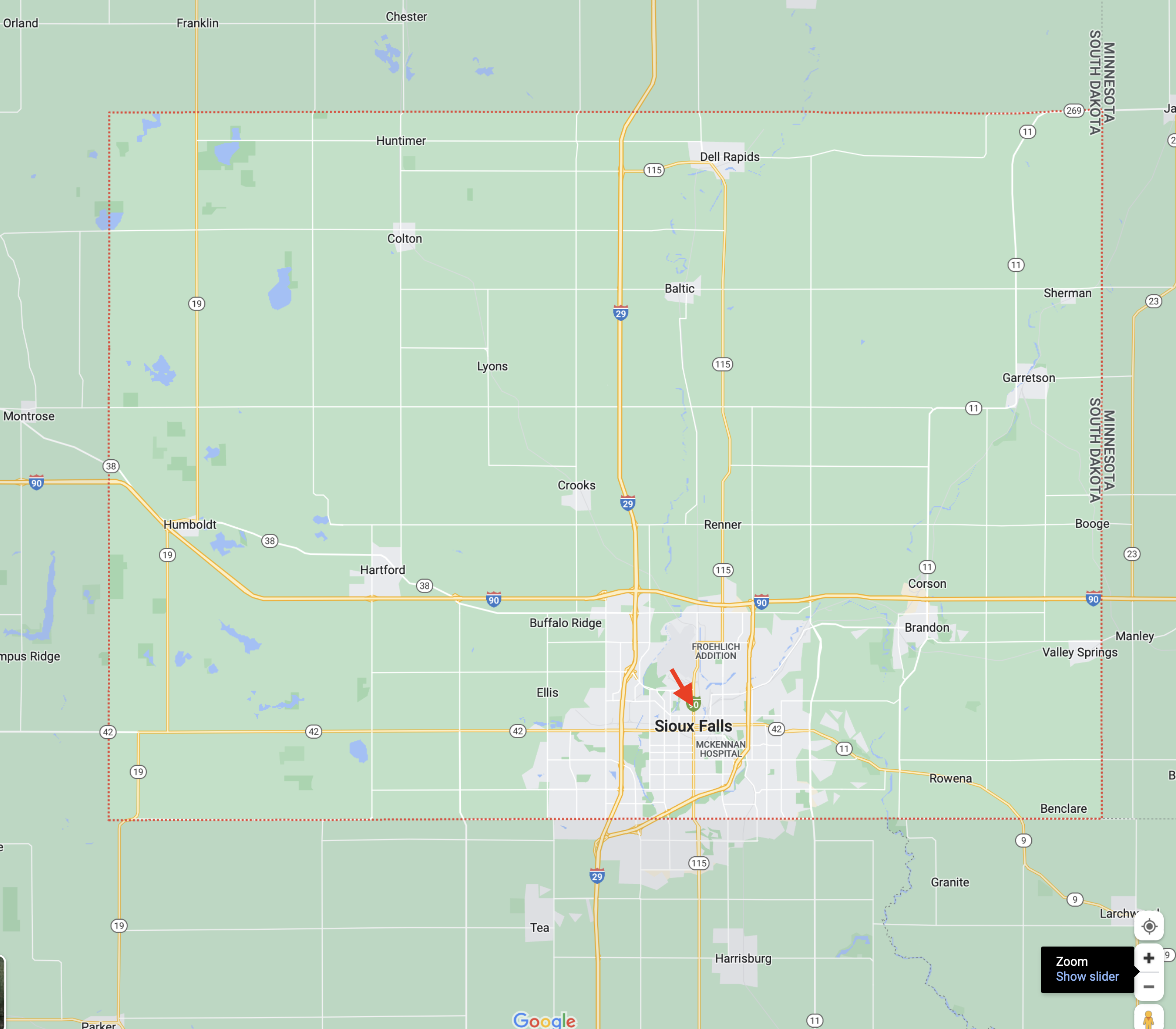
The center of population of Minnehaha County is at 917 North Minnesota Avenue, just three blocks up from the SFPD and St. Joseph’s Cathedral, just 4.35 miles north of the county line:
Plug your county’s center-of-population coordinates into Google Maps and find out how close you are to the center of life in your county!
Maybe the Governor can persuade several thousand out of state job seekers to give Gann Valley a try—it’s got everything they need but jobs and housing, and anchor our population, once and for all, in the county seat of Buffalo County.