Last updated on 2024-11-03
I’m out staying away from people in the Black Hills. If you’re planning to take a break this weekend (and you know, we could all use a break from the pandemic, the recession, and whatever new insults to decency and intelligence the man watching TV in the White House will come up with next) but still want to be coronavirus-cautious and avoid crowds, the Black Hills offer many opportunities for quiet, solitudinous vacation.
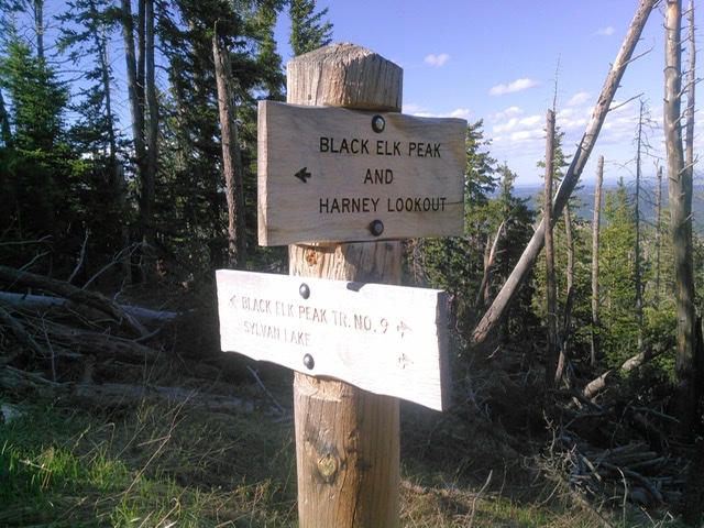
Hikers seeking solitude don’t go to Trail 9 during normal times, let alone during a pandemic. Yesterday, as usual, I met bunches of people (and dogs! Good brave dogs! Good dogs getting up those rocks! Treats back at the car!) It’s not disappointing to see people from all over enjoying the highest hike in South Dakota and the view from the top of our state, and our passing exposure to each other in the fresh piney air poses minimal risk of contagion (we’re all breathing hard, but the wind on the slope quickly disperses our droplets).
Still, I avoided crowded Sylvan Lake and came up Black Elk Peak from the north, from Willow Creek Horse Camp. (Be careful! The turn-off to the left comes up quickly around the bend as you come down from Mount Rushmore.) There were a half-dozen other cars parked on the grass when I got there, and the only other people I saw were a couple of gals just setting out up the trail. I put on my running shoes and followed on Trail 8 but then veered right on Trail 2, the Lost Cabin Trail, which somehow in thirty years of Black Hills adventures I’ve never taken (although I did lose a guy in my crew there once, as he got cocky, decided to blaze a trail, and ended up running halfway west around the mountain before getting turned around by someone he swears was his guardian angel).
I met no one on 2. No one. I took the spur east along the creek in view of the little meadows, past the great view of Little Devil’s Tower, through the crazy rock formations… and still no one.
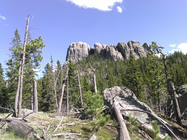
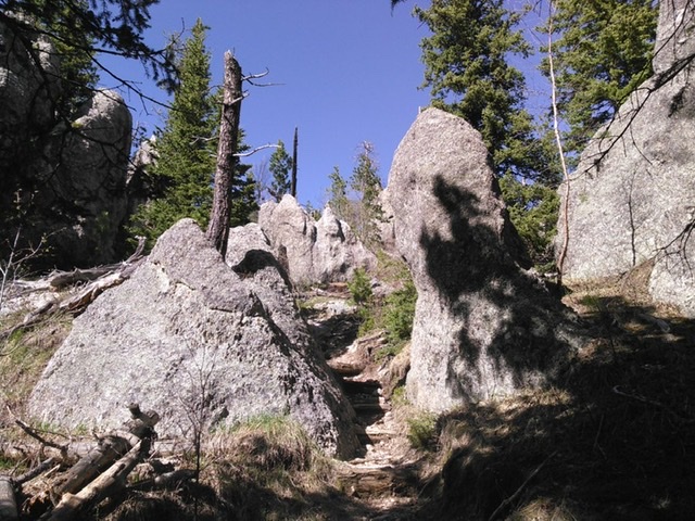
There are many more trails where you can get away from everyone. Getting up early helps. I ran from Silver City up the Deerfield Trail this morning and met only two other people—caught up with them, actually, on my way back down, near the gate. Otherwise, I had Rapid Creek, the bridges, the soft ground, and the bear cave (or maybe that’s Woster’s hideout?) all to myself.
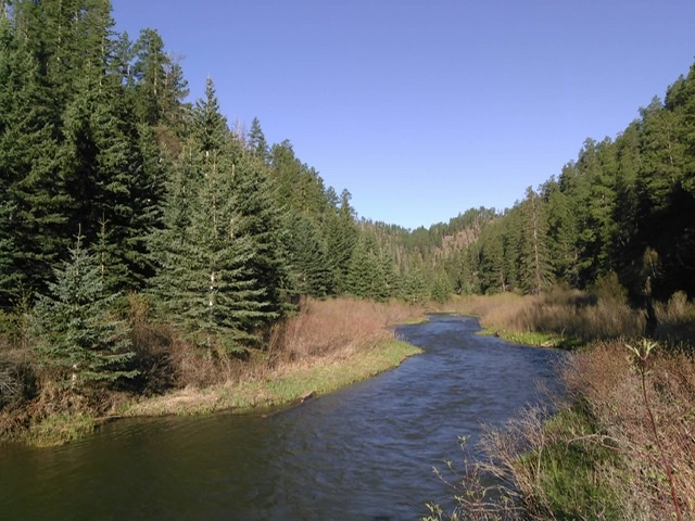
Now I’m up on some old grassy logging road in a spot that gets two bars of signal when the wind blows just right. A Forest Service truck passed me in a tolerable cloud of dust down on the gravel below, but since crossing the stream and climbing this road, the only people I’ve been aware of are the occasional four-wheelers I can hear sometimes in the valley below and the one guy on a pontoon I could see through my binoculars when I climbed a ridge and spotted the far west tail of the Pactola Reservoir. Now all I hear is the wind blowing through the pines, a sound of wind distinct from the in-town gusts in Aberdeen or the howlingest winds on the unobstructed prairie.
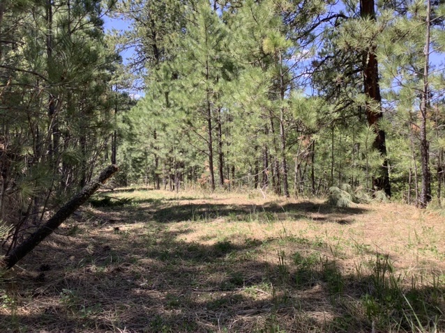
Getting away from everybody is good for the soul. And there are probably some people around you who won’t mind having you out of their hair for a bit.
Hit the trail this weekend. Hit a different trail.
This makes me miss the Black Hills. I had a favorite hike up Black Elk Peak that took a short cut up some rocky area. I remember one year doing that hike once every two weeks. There was a Rapid City psychologist, or maybe a psychiatrist, who ran up the Peak. He was nuts. No, it wasn’t Gus Hercules, who was a character, but not nuts.
Check out the ghost town of Spokane. Very cool.
Also, there are segments of the trail left by the Custer expedition of 1874 that are as good a combo of history and natural beauty as you’ll ever see.
Thanks for the photos, Cory. Like Don, I sure do miss the Black Hills. Northern Minnesota is lovely, but I prefer the Hills.
I was originally going to move to Rapid City, but instead chose Madison. The only trail around here is the bike path that starts on S. Egan at 8th Street. The trail follows Egan before turning to follow the bypass east. You then have to cross the highway at the four way stop and rejoin the trail as it continues to follow Highway 34 until it splits at the SD-19 interchange. You can either go on the south fork to the NW side of Lake Madison, or continue eastward about another mile or so as that fork weaves it’s way through a lakeside community, and eventually ending at Lake Madison as well.
This bike path makes for a rather nice walking trail on cool evenings, but there is a lack of natural shade on the portion leading up to the lakeside community. You also have to hear cars going by on 34, and depending on the time of day, it can be rather busy. Even so, I haven’t really encountered many people on the bike trail yet, and most times it’s only me walking the trail in the evening. I have yet to make a journey all the way to Lake Madison and back into town, but it is my goal.
Mr. Tsitrian, grudznick was told the old school house at Spoken has fallen in. Is this the case? Back in the day the my old friend Bob and his buddies would sneak out there and drink cans of beer and for years you could still find many of those cans you had to open with the pointy end of a church key. I suppose you still can.
Beautiful pictures. I could be there in July if family reunion isn’t called off.
If Governor Noem shuts the state down like the libbies still want, nobody will be able to hike in the woods or swim in the streams. I’m glad all you fellows are coming over to the “open it up” side.
There are still some buildings standing, Grudznick, but other than the house that the mine manager occupied, I don’t recall any of them being identified. Can’t say for sure if one of them was a schoolhouse or not.
As I have said before…The Black Hills is HOME for those of us who live here, for the rest of you it is just a playground. The deluge of visitors has started, it does every year. I personally avoid most of the places mentioned in the article during the summer having explored many of them many times as a child.
I also know how important those tourist dollars are to the Black Hills. What I would like to remind you: You are guests here! Respect the locals, respect their businesses…if clerks and workers are wearing masks, put yours on, and that means on the drive to get here.
Cory and the others who have commented here at least advocate hiking (or running) through the forest. My advice, leave your off-road vehicles and four-wheelers and side-by-sides at home…get off your fat backsides and walk…you need the exercise and the Forest Service has had to close some roads because the idiots like to tear them up when it is wet.
Balancing health well-being with economic well being is not fun. This pandemic is not fun. We need to, all of us, live defensively…and respect ALL others. My right to life, liberty, pursuit of happiness does not supersede your’s or vice versa.
As one of those with a fat backside, among other things, some of us have trouble standing up, let alone walking any distance. Having said that, I don’t own any mobile device to ride around on and would never bring it to the Black hills if I had one. And I would treat the Black Hills with all the reverence and respect for Mother Nature and natural beauty that I show any other irreplaceable wonder.
Unfortunately for myself, I will never see the Black Hills in person. So keep them photos coming.
Yeah, I really understand Ray’s viewpoint. When you live in the Hills area for any time, you tend to gravitate to where the tourists aren’t. But, then, if you are selling art or photography or anything else, you have to respect the tourists point of view, too. It’s an interesting balance.
I would take my daughter on short hikes up little used trails where she could work her “crystal mine.” No tourists, a few locals now and then, mostly just solitude, the wind in the pines, and the exclamations of my daughter when she dug out bits of mica and such, or find a wooly bear caterpillar.
Love it!
Two things. Last week on summits high above Pactola there are trash leavings, clearings and dozens of campsites left by “local” loggers scarring the wilderness.
Second, predictably, which USFS officer, likely influenced by Thune/Rounds, subverted Black Elk Peak with the innocuous “Harney Lookout” official nod to “local” red-necks (the fire observation tower was established 1911 after surveyor Lt. Warren brown-nosed the General gaining war trophies scavenged from the massacre field on Blue Water Creek, 1855 “revenging” Lt. Gratten’s unsuccessful attack over the emaciated Morman cow). Cowards.
mfi, breaks mah heart. If u are ever in the hills i’ll guide you where ever you wanna go!
Thank you, Leslie. Chances are I will never get there.
Ms. Leslie, as a “local” surely you know both that Cousins Pizza has moved and that the Harney Lookout is on the register of historic places. Black Elk Peak had its name changed from Harney Peak by the US Board of Geographic Names. The US Board of Geographic Names does not uburp or usurp the NPS National Register of Historic Places. The NPS National Register of Historic Places, has, voila, the “Harney Peak Lookout Tower, Dam and Pumphouse.”
The Forest Service Ranger Fellow who made that sign is being true to the legal names of the heavily trafficked places Mr. H is trodding about. Let us hope he cut no switchies and peed 200 feet from the trail, in accordance with the rules.
grudznick wins another debate. I have declared it. The Forest Service sides with grudznick.
The trash, like grdz the lobbiest knowlegable “local” troll here, ad infinenitum, is non-biodegradable and an eyesore, and the Forest Service guy is likely neutered to enforce pollution rules against miners, loggers and obviously this red-necked, racist, misogynist and malicious troll.
As a guest and as a two-year resident of Spearfish, I’ve always felt that tension to which Ray refers: I want everyone to come see and enjoy the Black Hills… but I don’t want to be where everyone is, and I don’t want everyone trashing the place.
Four-wheelers are just too loud. On foot and on bicycle, one can still hear the Hills. One also has more time, even in motion, to soak in a spot.
Cory, how can I connect with Mike from Iowa? You can give him my contact information if it is okay with you, mfi. Have a great Memorial Day weekend everyone!
Master, you have my permission to out me to Ms Hart.
I agree with you Cory, about the motorized traffic on the trails. For disabled people I could agree to electric motors but they must be slow, perhaps a top end of 10 mph.
I prefer walking. I lived in or very near the Hills for about 10 years and preferred the quiet, nontouristy places as well. It always ticked me off when someone decided to plant a house in my little piece of heaven. Still, relocating was a new adventure. I usually preferred Nemo Road environs.
Damn, I miss the Hills. 😥
Do you take a topographic map and compass with you when out tramping around off the beaten trail?
Nick, I always bring my compass, and I sometimes bring topo maps (often from my old copy of Hiram Rogers’s guide to Black Hills and Badlands trails). This time out, however, I stayed mostly to beaten paths, so detailed papers weren’t necessary.