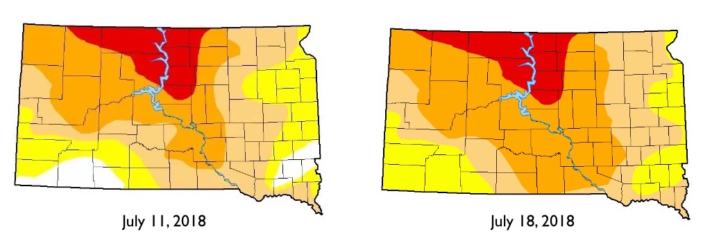
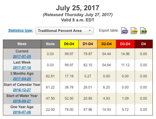
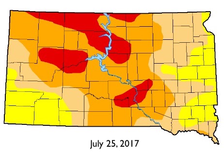
Drought persists unabated in South Dakota, according to this week’s UNL Drought Monitor report:


Abnormally dry or drought conditions continue to cover all but 0.03% of the state. 3.84% of the state moved up to D3—”Extreme Drought”. South Dakota currently has the highest percentage of land in abnormal dry or drought conditions in the U.S.
None of South Dakota has entered the driest category of D4, “Exceptional.” That dry distinction goes to Montana, where a northeastern blob covering 11.87% of the state is in D4, and North Dakota, with 7.62% of its turf in D4, all in the western part of the state.

so what? Montana has much more land in drought, 71,854 square miles, almost as much as the entire state of South Dakota; and more than all of North Dakota, compared with the paltry 61,724 square miles of drought in South Dakota, including the tearless visages on Mount Rushmore.
Big Sky, Big Dry.
The take away is that we aren’t as good of Christians as we claim to be, otherwise God wouldn’t be punishing us with drought.
UNL says 71,897.77 square miles of MT and 223,431 Montanans, 22.58% of its population, are in D1–D4, while 61,682.18 square miles of SD and 413,100 South Dakotans, 51.65% of its population, are in D1–D4.
To quibble with language: I agree that 10,000 square miles is a lot of land. However, I would not say that 62K is “paltry” compared to 72K. Paltry is a flexible, non-specific term, but I don’t think you have “paltry” until you’re at less than half of some other benchmark.
I won’t quibble with
65% of Montana is farmland and 90% of South Dakota is farmland.
http://www.stuffaboutstates.com/agriculture/farm_by_total_acres.htm
Hmm… so arguably, drought extending over X% of SD could harm more ag production than drought extending over X% of Montana. But to see what’s really happening, we’d have to overlay the drought maps with the arable land maps.
Plus, even land that can’t be farmed still matters for ag. Maybe Montana’s drought land percentage includes a lot of non-arable, non-grazable mountains, but precip on those mountains runs off into the Yellowstone and Missouri to provide irrigation in the arable areas.